
by Dwayne Phillips
Now at least I am in the right calendar year.
On this Saturday, I walked from Leesburg to Purcellville, Virginia. This was ten miles on the W&OD trail. I walked alone and completed this in 3 1/2 hours. That is a speed of three miles per hour, so I probably walked too fast.
This walk segment was the first time I brought my camera with me. I took several photos and put them on pages in Wikipedia. One is a photo of the train station in Purcellville at the end of the trail. Another is a photo of a church building in the town of Hamilton, Virginia which is a little to the east of Purcellville.
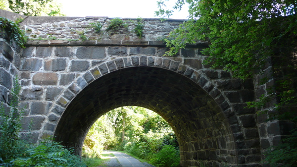
Here is a photo of the Stone Bridge at Clarkes Gap. This is the highest point on the W&OD Trail.
The weather was great. I started at 65 degrees and finished at 75 degrees.
I saw a lot of bicycle riders, especially at both ends in the towns.
Purcellville is the western end of the W&OD trail. The only trouble is that I parked my van at the wrong spot in Purcellville. I wandered about for half an hour trying to find it. Three stops to consult my map led me to the right place.
Tip for the future: pay attention to the where you park.
Some history: Leesburg, Hamilton, and Purcellville used to be in “horse country” in Virginia. Slowly and surely, they are becoming suburbs of Washington D.C. I find this to be a shame as this is beautiful country.I wince when I see 100 aluminum-sided townhouses in a row.
0 responses so far ↓
There are no comments yet...Kick things off by filling out the form below.
You must log in to post a comment.