by Dwayne Phillips
Today we walked from Greeneville to Bulls Gap, Tennessee. We covered 18 miles. A cloudless day, the temperature ranged from a chilly 40 degrees F to a perfect 70 degrees F.
Route 11E is a four-lane divided highway for 15 of our 18 miles walked today. This is like walking on the side of an Interstate highway. The traffic was heavy through the morning with lots of wind and noise once again. This died down mid-day. That was a joy. The countryside is beautiful. The most pleasing was a small area called Harmons Valley. I don’t know if this place is even on a map, but several churches and businesses had that name.
One of the most pleasurable times of the walk is standing on the roadside at the peak of a hill and viewing a valley below. One of those times happened today. That makes the day, the entire trip, worth every blister, every ache, and every bad motel room. I believe God made hills just so He could make valleys.
Route 11E bypasses the town of Mosheim pronounced Moss-Heim after a German Lutheran theologian who first settled this area. I read this bit of trivia in Wikipedia. It seems that a lot of locals think Mosheim is a Cherokee word. Anything-heim a Cherokee word? Oh well, keep walking.
Route 11E crosses under Interstate-81. We had not seen good old I-81 in three or four days. An old friend returns for the last time on this walk.
After I-81, Route 11E returned to a two-lane road that winds through a rural area. The shoulders are narrow, the traffic was heavier than expected, but the roadside sites that interest me most also returned.
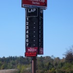
Immediately south of I-81 on Route 11E is a racetrack. It is associated with NASCAR and such, but I believe it is a dirt track. Here is a photo of the sign. I guess it is called “Volunteer Speedway.” The red letters “VOLUNTEER SPEEDWAY” at the bottom of the sign flashed across in a sequence of several messages. I tried taking this photo four or five times before I caught it on the display. 
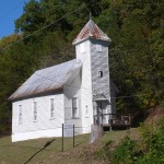
Here is a little, old church building sitting right on the road. Something about it caused me to take this photo. 
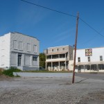
We ended the day in the small town of Bulls Gap. There are a couple of stores, a medical center, a couple of gas stations, and such on Route 11. One “block” off is “downtown.” We went over there and I took this photo. Downtown has five or six two-story brick buildings. The buildings are almost all abandoned. There is a railroad track going through downtown. It seems that the downtown area starting dying when the train stopped stopping here. A long freight train was chugging through town while we were there. I know it is business in a free enterprise system, but it is sad to see a town die because of a business decision. I put this photo on the Wikipedia page for Bulls Gap. 

0 responses so far ↓
There are no comments yet...Kick things off by filling out the form below.
You must log in to post a comment.