by Dwayne Phillips
I reached the southern terminus of U.S. Route 11.
Today’s was a 17-mile walk. The weather was fine again, a little warm, with 65 in the morning and 80 in the afternoon and few clouds in the sky.
I walked through Slidell and Irish Bayou, Louisiana as well as the Bayou Sauvage National Wildlife Refuge.
Slidell is a fairly big city with motels, businesses, several schools, and so on. It has a nice old downtown area as well as all the trappings of the Golden Mile stretching both North-South along Route 11 and East-West along Route 190 as well as Interstate 59/10 and Interstate 12.
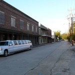
The Wikipedia page for Slidell has a few photos already. I put a photo of the train station that is in old downtown. It is a working station with Amtrak service. It also has a bar in it. Leave it to south Louisiana to have a bar in a train station. Here is a photo of one downtown street.
I enjoyed walking through Slidell – about 5 miles North to South. They have a sidewalk the entire length of the city. Some one take note of that.
South of Slidell you see lots of water everywhere. Most of this area was wiped clean by Hurricane Katrina, so almost everything above ground is new. Some one thought this was humorous or something to stick a plane fuselage into the mud. I like it.
Note about the landscape here – the land is as flat as water.
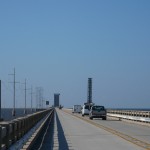
The next big thing is the Route 11 bridge across the narrow part of Lake Ponchartrain. This bridge is five miles long. Look at this photo of the roadway carefully. The roadway does no rise, that is a drawbridge up in the air. The large object pointing way up in the air to the right is the train drawbridge. They have to raise these for almost any boat. The train bridge is only 3 or 4 feet above the water while Route 11’s bridge is may 8 or 10 feet above the water.
I walked four of the five miles of the bridge’s length. A couple of New Orleans Police gave me a ride for the last mile. They said that walking on the bridge is not allowed. I looked high and low for signs prohibiting pedestrians. I spent a half hour last night looking on the Internet about this as well. Oh well, I got enough of the experience and the officers were courteous.
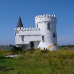
South of Lake Ponchartrain is an area called Irish Bayou. At this point, Route 11 is about 18 inches above the surrounding water. That felt funny walking through there. All the structures are above ground in one way or another. All except this one – a castle. The curved walls and concrete construction are pretty good in a storm. It looks neat as well.
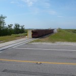
Then I entered the Wildlife Refuge. At the entrance is this flood gate on rails. It is about four feet tall. In the event of a storm surge they close it to keep the water from…well I don’t know. It doesn’t seem to make sense to me, but it is here at taxpayer’s expense.
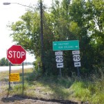
And then I reached the end. There isn’t much at the end of Route 11. It seems there should be a big marker, after all this Route goes from upper New York state down to here – at the end of dry land. All that is here are these signs. Sort of anti-climactic.
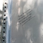
To mark the occasion, I wrote this note on a sign down here. I won’t say which one, but here it is. Take a trip down to the terminus and look around. It won’t be hard to find.
.
In the coming days, I will catch up on some other things that have happened while walking. Stay tuned for a while.
.
.
.


0 responses so far ↓
There are no comments yet...Kick things off by filling out the form below.
You must log in to post a comment.