by Dwayne Phillips
 Instead of walking into Georgia, we drove back to Northern Virginia. An early morning e-mail from my oldest son informed us that he and his wife were at the hospital with her in labor. She gave birth to a healthy boy – James Timothy Phillips. The new mother is also in excellent health.
My chief of the support crew (my wife) is now far more inclined to be a grandmother than a support crew chief. Unless I can recruit another such crew chief the walking will stop for now.
My goal was to accomplish one third of the walk by November. We have accomplished one half the walk in the same time, so I am quite happy with our progress.
I will now take some time to write from notes that I have taken and put on the side.
And by the way, it is a great feeling to be a grandfather. And by the way, I have the most wonderful daughter-in-law in the world.
Tags: Uncategorized
by Dwayne Phillips
Today we walked by Ooltewah and through Chattanooga, Tennessee. Another fine day with temperatures from 45 to 75 degrees F. Sunny and calm.
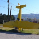 This airplane is posed nose down in front of a salvage yard in Ooltewah. Kind of neat. There isn’t much else to say about Ooltewah as Route 11 sort of passes it by.
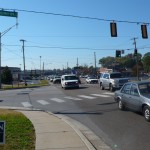
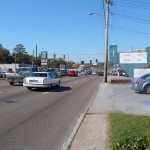
Chattanooga, well it is a big city. Route 11 passes through it as a four-lane road. It is basically all golden mile stuff that looks like this and this. Major parts of Winchester, Harrisonburg, Bristol, Konxville, and such look exactly the same. The only differences are the license plates on the cars. Boring. Walking through such traffic is noisy, windy, and sometimes dusty.
But anyways, this is about an 1,100-mile walk. Chattanooga is about 550 miles out from home. Hence, half way. My goal was to walk a third of the way by November 1st, so we are ahead of schedule. It is helpful to have a support car with you as it allows you to walk 18 miles a day as a routine. I had thought that 10- and 12-mile days would be the norm.
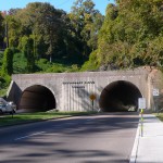
 One interesting thing in Chattanooga is the Missionary Ridge Tunnel. If you look closely down the right tunnel, you can see out the other side. This is about a quarter mile long.
When we finally exited the south side of Chattanooga we walked past this. It is the International Towing and Recovery Hall of Fame and Museum. Long name, strange, but a great sculpture out front.
Georgia looms on the horizon.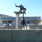
Tags: Bradley County · Hamilton County · Tennessee
by Dwayne Phillips
I have mentioned Community Coffee a couple of times this week. This is a Louisiana brand of coffee that started in Baton Rouge about 90 years ago. Both our families drink it at home in Louisiana. Some of the Community Coffee is made with chicory blended in with the coffee. That is my favorite.
Up until a few years ago, you could only buy Community in Louisiana near Baton Rouge. Now it is being marketed in a few other southern states. I was surprised to see it in a few gas stations in Tennessee. Now I look for it. I like it about the same that I like Starbucks, but it cost much less per cup.
I like it much more than Folgers and Maxwell House and such.
Tags: Uncategorized
by Dwayne Phillips
Today we walked through Cleveland and McDonald, Tennessee. The temperatures ranged from 35 degrees F in the morning to 70 degrees in the afternoon. We walked a little over 18 miles.
We started north of Cleveland and walked the first hour of the day in the fog. That is interesting. It is a good thing that you can hear the cars coming. The cows look funny in the pastures. No word from the cows on how we looked in the fog.
Route 11 sort of skirts through one side of Cleveland. It is a four-lane divided highway full of fast food and all other sorts of suburbia. Today was Saturday, and the suburbanites were out running their errands in earnest. I have done this myself many times. I know it is necessary, but it is awful boring to walk down the middle of it.
One tidbit, I stopped in a Chick Fil A for a cup of coffee. Several mothers were there with their children (indoor play place). These women were wearing their flannel pajamas and bathroom robes. I know some Saturdays are tough to get started, but really.
On the way out I read a sign that advertised a special they were having – free breakfast if you come in your pajamas. Okay, but didn’t Hugh Hefner used to do this pajama kind of thing?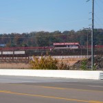
The walk became interesting after we left Cleveland. Back to a two-lane road with almost no shoulder – but no fog. First up is this race track. I think it is a dirt track.
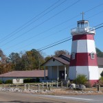 Next up is this lighthouse next to a church. This is a memorial to a couple of members. I have seen people plant trees and erect small monuments to departed ones, but never build a lighthouse in the hills of Tennessee.
Oh the hills, beautiful to see. Winding road with lots of up and down. We met maybe a dozen people out on motorcycles. A good Saturday afternoon ride in the country. This section of Route 11 must be a local secret.
I was all set for a quiet, nothing-to-see afternoon walk. Wrong. I walked past the Bachman Academy. This is an exclusive ($$) private school that specializes in kids with ADHD. That is challenging work. It is a large place with 200 acres and horses.
Did I mention horses? I was shocked to find that we were on a road that has two large horse farms – Bendabout Farm and Manderleigh Farms. I found little on the Internet about these two. I know that Bendabout holds polo matches. I think Manderleigh raises and sells race horses. Both places are large (several miles of road front) and both places are immaculate.
I saw a group of young horses (someone who knows horses tell me the correct noun) running full speed through the pasture at Bendabout. Nice animals. Again, big $$$.
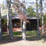 Then there is the wide spot in the road of McDonald. It has one store, two churches, and a post office. Here is the post office. For once, the Feds didn’t flatten a spot, pour concrete, and drop the building in the middle. Someone did a good job of nestling the Post Office up in the trees.
Here is a photo of the local Methodist Church. This building has great windows. I hope you can see the details here. 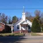
Tags: Bradley County · Tennessee
by Dwayne Phillips
It seems strange to be away from home on Halloween, let alone doing what we are doing. No one will come to our motel door and ask for candy. Anyways, we walked through Athens, Riceville, Calhoun, and Charleston, Tennessee. We covered 18 miles in good weather. A little chilly at 35 degrees F to start, but it warmed quickly.
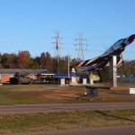 Route 11 passes between the city of Athens and Interstate 75. It is a four-lane divided highway through here. We really didn’t see anything of Athens. We saw the basic tractor dealers, car dealers, fast food, Wal-Mart, a big high school, and so on. I did get this photo of the VFW on Route 11. They have an airframe of an F-4 fighter plane, I believe that is an M-60 tank, and I cannot recall the name of the armored vehicle. Someone help me with that. Great static display for a VFW.
If you can read the sign in front of the VFW you will notice a turkey shoot advertised. I have seen half a dozen such shoots advertised this week. Let me explain – they are not actually shooting a turkey. This is a traditional fund raiser (traditional in the south at least) as Thanksgiving nears. You pay a dollar or three, use the firearm supplied by the organizer (usually a 22 rifle), and shoot at a paper target. The best target wins a frozen turkey from the grocery store. It works quite well and is a lot of fun to do.
A highlight of the morning was the cup of Community Coffee I bought at a gas station on the south edge of Athens. Good stuff, and less than a dollar. 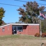
Route 11 remains a four-lane divided highway through the countryside until it reaches the town of Riceville. Riceville is so small that it doesn’t have a page on Wikipedia. There are two gas stations and a U.S. Post Office there. Several of the letters have fallen from the front of the Post Office. Here is a photo. Riceville looks like a town in an economic depression. We ate lunch sitting in a parking lot of a closed bank. How does a bank close these days? Riceville is probably best known as the place where Route 11 goes back to two lanes.
Most of the rest of the day was spent walking through rural areas. There are plenty of nice farms and several recent housing developments along the road. The houses are surprisingly opulent.
The day ended at the twin towns of Calhoun and Charleston. There is a very large factory at Calhoun owned by Abitibi Bowater. This is one of the largest news print mills in North America. Everyone in these two towns works at the mill or sells stuff to people working at the mill. The economy in these towns appears good.
We didn’t see anything of Calhoun except a Hardee’s and a couple of small nick nack stores. I guess the town is off of Route 11.
We crossed the Hiwassee River (pretty wide and the bridge is pretty big) into Charleston. Charleston seems much bigger than Calhoun. Maybe all of Charleston is on Route 11. There was no main downtown area, but half a dozen stores, three national fast food places, a school, and even a mile of sidewalk.
These are two nice little towns. The Wikipedia pages for Calhoun and Charleston have photos of the towns.
Tags: Bradley County · McMinn County · Tennessee
by Dwayne Phillips
Today was a full day – 20 miles with many attractions and events. We walked through Philadelphia, Sweetwater, and Niota, Tennessee. This may be a long post. It was 32 degrees F this morning with frost. The weather warmed quickly, we stripped off all our extra layers, and it ended at near 70 degrees. Not a cloud in the sky all day. Beautiful.
I love this type of landscape. Walk five miles, go through a town, walk five miles, go through a town. Great.
The day started out in the countryside. The first “town” was Philadelphia (appropriate on 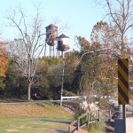 the morning after that other Philadelphia won the baseball World Series). Route 11 sort of passed by Philadelphia as the town was maybe a quarter mile to the west. I am surprised to report that not only does Wikipedia have a page on this town, but also photos of it. I took this photo of the twin rusty water towers. It is rare to see two water tower close to one another, especially in such a small place.
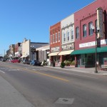 After another few rural miles, we walked through Sweetwater. This town has a great downtown area. It is only two or three blocks long, but well kept and busy. The unique thing is that it only has buildings on one side of the main street. There are several small parks downtown with bandstands. I like towns that have bandstands. I assume they occasionally have live music. Here is a photo of the downtown area.
The Wikipedia page for Sweetwater already has several nice photos of the town.
One other thing about Sweetwater. On the north side of town up on a hill sits a large brick building. The building is hard to see, but has a military look to it. This was once the Tennessee Military Institute. Then in 1989 it became the Tennesse Meiji Gakuin High School. That was associated with the Christian university of the same name in Japan that opened in 1863. I know this is going around in circles. This high school closed in 2007. It was a boarding school for Japanese high school kids whose parents were working in the U.S. It prepared them to attend colleges in Japan.
I don’t understand why a small town in Tennessee had such a school. Are there many Japanese nationals working in Tennessee? Someone help me with this.
Then the oasis. South of Sweetwater we walked upon this place (not a good photo I confess). The Spring Creek Crossing – a true oasis for a weary walker. It had several restaurants and stores all in one place. They don’t sell junk as this is not a flea market. They sell good, old, historical items. Where did this place come from? We spoke with the owner and several of the people there. I cannot express my surprise at this place. A really good place on the side of the road just north of no where. 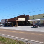
If you are traveling Interstate-75 in Tennessee, this place is to your east a couple miles. Take exits 56 and head north or exit 60 and head south. Skip all the corporate stuff at the Interstate exits. Take half an hour out of your trip and visit this place. Amazing.
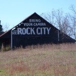 Oh, and by the way. Across Route 11 from Spring Creek Crossing is this See Rock City barn. This one is in the best condition of any I have seen. All the words are still standing.
After Spring Creek Crossing, we came upon a road construction project. The crew was stripping off the top couple inches of asphalt. The result was dust. We walked five miles into traffic that stirred the dust and threw it into our faces. We made a note that if we came upon such a project in the future that we would drive though it. It wasn’t pleasant.
Our final town of the day was Niota. This is a really small place that Route 11 runs right down the middle. Niota has two gas stations, four churches (three of them Baptist, the town sign proudly proclaims this), one school (K-12 all in one), and a gold course. A golf course! How does such a little town get a golf course?
A word about the gas stations. I stopped in one for a quick snack. They didn’t have RC Cola and Moon Pies, so I got the next best thing – a big bag of Fritos and a Coca Cola. The second gas station sold Hunt Brothers Pizza (more on that pizza in another post). I haven’t seen Hunt Brothers Pizza in a hundred miles. Nice to see it again.
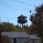 To top off Niota is this rusted water tower. The tower is so small that you cannot read it without walking around it. It reads “Socktown.” There is a sock factory at the north end of town that was established in 1902. I guess Niota has always been known as a sock-making town.
I have more to write from today. I will try to put that into other posts.
Tags: Loudon County · McMinn County · Monroe County · Tennessee
by Dwayne Phillips
Today we walked through Lenoir City and Loudon, Tennessee. We covered 18 miles for the second straight day. The skies were clear last night, and the temperatures plummeted to 30 degrees F. Thankfully, it wasn’t windy during the morning. It was windy in the afternoon, but the temperatures had climbed to almost 50 degrees.
Frost this morning. That is the first time we have seen frost on this walk. There is a glorious half hour in the morning when the sun hits the frost and the golf courses and pastures sparkle with silver. We started at a golf course at the western edge of Knoxville and then quickly went into rural areas as Route 11 actually turned to the south.
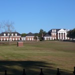 Here is a photo of a big house on the north side of Lenoir City. This seems to be three or four houses connected, but it is one big one. This is the biggest house I have seen on Route 11. I have no idea who owns it or why they would build such a place. It is beautiful.
Route 11 goes right down the middle of Lenoir City as the main street. Here is a photo of downtown. It is well maintained and eight of ten shops are occupied with current businesses. They have a large city building that houses a career training center, a community college, and a public library. I like libraries on main street. They seem to belong there. The funny thing about the downtown area is that it has pedestrian crossing lights. You know, push the button to cross the street, wait until the sign says it is okay to cross, don’t cross when the sign says stop. I cannot understand why they need such in this city. It must have been some type of urban renewal grant.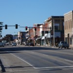
We crossed the Tennessee River into the town of Loudon. The Tennessee River is big at this spot, and the bridge is big as well. Here is a photo of the Loudon County Courthouse right off Route 11 in Loudon. Loudon has a small downtown area, but it is a good 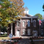 one. The storefronts are occupied and the stores are open.
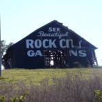
We ended the day at this barn with a “See Rock City” ad painted on it. This barn shouldn’t last too many more years. It is mostly gone on the sides hidden from view in this photo. That is a shame. Why do barns collapse first at the bottom? It seems the tops would fall out first.
One last item. We bid farewell to Interstate 40 when Route 11 turned south. Route 11 nows runs parallel to Interstate 75 as it crosses Tennessee from top to bottom.
Tags: Knox County · Loudon County · Tennessee
by Dwayne Phillips
Today we walked through Knoxville, Tennessee east to west or north to south if you follow Route 11. It was COLD today. The temperature was 40 degrees F in the morning with a steady 15 mile per hour wind. The lady at our motel told us they usually don’t have this type of weather until December. At one point in the morning I saw a couple of snow flakes, but since no one was with me to confirm this I won’t report it.
Knoxville is a big city in the south. I think it is the biggest city we will transit on this walk. The east side of downtown is old and decaying. There were plenty of businesses open on Route 11, but we could see the decay just a block or two off the Route.
We couldn’t walk through downtown. We tried, but there was construction on Route 11 (Magnolia Ave). We took the detour by car, but could not find our way back onto the right street. After several trips through downtown and across the river, we doubled back and found our way onto Cumberland. This went on the northern edge of the University of Tennessee. That is Route 11.
I found two more Starbucks on Route 11. That brings us to a total of four (or is it five?). I stopped in one for a cup of coffee. The sales tax is awful. $1.80 for a small cup of Starbucks. That costs $1.63 in expensive Northern Virginia. Ouch, but that is the way to do it, tax out-of-state travelers.
In the area of the University of Tennessee are big, beautiful, and expensive homes. That is what I expected to find as it seems the norm near large, central universities. The same is true in Baton Rouge, Louisiana near LSU. I have never understood this. Professors at the universities don’t make the money to buy these homes. As far as I know, only the football and basketball coaches (this is the South Eastern Conference) make that kind of money. Who owns these homes? Who built them? What is the deal here? Does anyone know?
I took several photos of these homes. I didn’t post them as I was having trouble with the WiFi at the motel tonight. Sigh.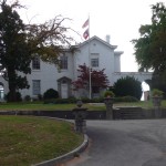
Here is a photo of the “Bleak House.” This was used by General Longstreet (Confederate General) during his seige of Knoxville. That is something different here. The big memorial markers honor Union and not Confederate Generals. Whose side was Tennessee on during the Civil War?
Here is a photo of a Greek Orthodox Church. I was impressed with the architecture. I was also impressed to find a Greek Orthodox Church in Knoxville. They must have an interesting history to be here.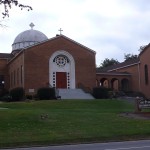
Here is a photo of the gem of the day – an old motor court. I think it is still operating, but it could be open now as an apartment business instead of a motel. The sign is great, so I couldn’t pass it up. The title “11-70 Motor Court” is because U.S. Routes 11 and 70 run concurrently here. 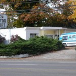
It is obvious that Knoxville is growing to the west. The middle and upper-middle class neighborhoods are all to the west of the University. Shopping centers one after another, restaurants, motels, churches, private schools and all the other attractions of economically prosperous neighborhoods in the south today. I have no complaint about these, but it is boring and noisy (traffic) walking.
Tomorrow we finally exit the city of Knoxville and get back to a rural area.
Tags: Knox County · Tennessee
by Dwayne Phillips
I visited the dentist yesterday. All is coming along as planned (by the dentist).
Insert you favorite Dentist joke here. Laugh a minute and continue reading.
Actually, I have very pleased with me dentist. He is simply good at being a dentist. He knows where to stick the needle and how to touch the teeth with the drill. He pulled a tooth last month and I really didn’t know when he was finished.
So, Monday we should drive back to Knoxville and start walking on Tuesday. Four days without walking is a nice break for the feet and legs. I am ready to go back to the road.
A friend asked me a question today, “what are you learning?”
I had not given that much thought. I will pass along the question.
What have you learned by reading this blog?
What does it seem that I have learned since taking a walk?
Tags: Uncategorized
be Dwayne Phillips
We entered Knoxville and made it to the point where Route 11E rejoined Route 11W to become plain old U.S. Route 11. Today was a short day of walking. After walking, we drove eight hours back to Reston, Virginia so I could go to the dentist tomorrow. The weather was a little warmer – 45 degrees F and sunny.
We crossed the Holston River and then crossed Interstate 40 for the first time. This sign looks back at where Route 11 splits into 11E and 11W. It seems there should be some marker indicating that the two become one again, but alas that must not be so important to highway marker makers.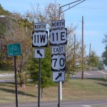
I know we are in Knoxville – not because of signs. I don’t know how in the world cities decide where to put the city limits signs. Anyways, you are in the city when you are walking on sidewalks. We made it that far.
I visit the dentist tomorrow. I hope it is the last visit for a while. It will be good to see our kids and friends at home again.
Tags: Jefferson County · Knox County · Tennessee
 Instead of walking into Georgia, we drove back to Northern Virginia. An early morning e-mail from my oldest son informed us that he and his wife were at the hospital with her in labor. She gave birth to a healthy boy – James Timothy Phillips. The new mother is also in excellent health.


