by Dwayne Phillips
I am seeing this sign more often the past week in southwestern Virginia and northeastern Tennessee. Mostly at car dealerships – used car dealerships.
These businesses make their money on financing. There is no telling what kind of interest rates they charge and what they find for collateral. My guess is they use land that either the buyer or a relative of the buyer owns.
I went to high school in a rural area, and my mother still lives there. It is common for a parent to give an adult child a corner lot of the family acres. This practice means that many under-employed or unemployed adults “own some land.”
The car dealers sell cars with zero-down and a high interest rate. They “buyer” gets a car with monthly notes that they usually can afford. A few missed payments, and the car dealer gets the land.
A similar deal occurs at the mobile and modular home places we see everywhere in the rural areas. They often advertise “You own land? Zero down.” The land – given to the purchaser by a parent – is the collateral. You miss a few payments and the home seller gets the home and the land.
These are legitimate business practices. As always, only borrow what you can repay. I have, however, seen families ruined by an adult child that takes advantage of the family acres to buy things, never pay for them, and ruin the family acres. Some parents cannot say no to some of their adult children.
Tags: Uncategorized
by Dwayne Phillips
Today we walked through Jefferson City, New Market, and Strawberry Plains, Tennessee.
Note: Not all of the towns in Tennessee have two words in their names; it just seems that way.
The weather again was chilly – 40 degrees F in the morning and 50 at quitting time. We did indeed cover 20 miles – the first time we hit that distance. Conditions were just right (or just wrong depending on how your feet feel) to cover that distance today.
Route 11E returned to being a four-lane divided highway. Sort of the Interstate for this area of Tennessee. As such, it pretty much bypasses the towns. I think we “missed” several towns along the way that we never saw any evidence of their existence.
Jefferson City is a good example. Route 11E is a Golden Mile on the edge of town. Wal-Mart, Lowes, gas stations, and every national fast food chain is on it. Off to the left was the town, and we only had a glimpse of it now and then. That is a shame.
New Market wasn’t much better. We saw a couple of gas stations on the side of the road. We did eat our lunch at a roadside park in the New Market area. It was nice to sit at a picnic table, eat a sandwich, pop a few blisters, patch them with moleskin…no wait, that isn’t a good lunch time topic. The sandwich was good.
I put a photo of the New Market Post Office on the town’s Wikipedia page. Why would anyone use dark brown letters on dark brown bricks? See the photo to understand my displeasure.
After New Market another “See Rock City” barn. Great stuff. I love it. 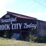
Note, Rock City seems to be more famous for the barn advertisements than for the place itself. Over 900 barns in 19 states were painted with this type of advertisement. Well, I have seen two of them.
The countryside for most of the day was beautiful. There was a few hours in the afternoon when I was strolling along, feeling the sun, feeling the breeze, listening to my iPod – just great to be out here. I am sure some people would find this boring, but I love it.
We ended the day at Strawberry Plains – a great name for a town. We even pulled off the highway and drove through what we thought was going to be a town. A few old houses and a school. This reminded me of my high school – Loranger High School in Loranger, Louisiana. K through 12 is all in a few buildings in one spot. There is a football field with bleachers that could hold maybe 200 people. Yes, just like my high school. Funny thing is that the area around my high school is known historically as a strawberry-growing area.
I put a photo of the Strawberry Plains Post Office on the town’s Wikipedia page.
Tags: Hamblen County · Jefferson County · Tennessee
by Dwayne Phillips
Today we walked through the little towns of Whitesburg and Russellville and the big town of Morristown, Tennessee. The weather was again fine – a chilly 40 degrees F in the morning but a good 65 degrees in the afternoon.
The first site of the day was this barn with a “See Rock City” advertisement painted on it. I have seen several miniatures of this thing hanging in trees on the roadside. My step father once bought one of these and hung it in the yard.I don’t know if this is the original or is unique. Perhaps it is one of many barns with this sign painted on it. I think the bottom of the sign has fallen off and is supposed to read “Chattanooga Tennessee” (the location of Rock City). This is a great use of a side of a barn. Paint it with something interesting and give the farmer a few dollars.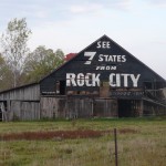
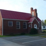 Whitesburg doesn’t have a Wikipedia page. I don’t know why not as it is bigger than many towns that do. It has a Post Office, an elementary school, several gas stations, and several churches. Here is a photo of the Presbyterian church. I liked this building. It is small and made of brick. Most buildings of this size (like the one pictured in yesterday’s entry) are only of wood.
Russellville does have a Wikipedia page. It is the same size as Whitesburg with the same businesses, schools, and churches. It is supposed to be much older according to Wikipedia. It seems to me that the historic sites are either miles off Route 11E or have been plowed under. I put a photo of the Russellvile Post Office on its Wikipedia page.
Now to Morristown. This town has about 15,000 residents. It has several huge 1950s-era church buildings downtown. The nice thing about Morristown is that Route 11E goes right through it, so we did as well. Interstate-81 is several miles away from the town.
Morristown is unique in that in its downtown it has a “skywalk.” Look at the photo. The skywalk is a cement walkway that goes along the second floor of the buildings in the two-block long old downtown. We walked the skywalk end to end.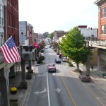
This other web site has a lot of chat about the skywalks and more photos. It seems they were built in the early 1960s under a Federal government grant dealing with of all things “flood prevention.” Yes, if you were walking on the skywalk you would not get wet by a flood. Crazy use of taxpayers money.
Anyways, the skywalks did not revitalize downtown. There were no second floor businesses. There were a lot of stores on the street level that looked like someone had a business recently, but were closed. Not an attractive place. If anything, the skywalks make it look ugly. Dark, dreary, stained concrete everywhere. Oh well, I guess that is why you don’t see these skywalks all over the country.
The treat at the end of today was a flyover by a DC-3. I have no idea of the origin, destination, or purpose of this 1940s beauty being in the sky. Just one of those great moments out in Real America.
Tags: Hamblen County · Tennessee
by Dwayne Phillips
Today we walked from Greeneville to Bulls Gap, Tennessee. We covered 18 miles. A cloudless day, the temperature ranged from a chilly 40 degrees F to a perfect 70 degrees F.
Route 11E is a four-lane divided highway for 15 of our 18 miles walked today. This is like walking on the side of an Interstate highway. The traffic was heavy through the morning with lots of wind and noise once again. This died down mid-day. That was a joy. The countryside is beautiful. The most pleasing was a small area called Harmons Valley. I don’t know if this place is even on a map, but several churches and businesses had that name.
One of the most pleasurable times of the walk is standing on the roadside at the peak of a hill and viewing a valley below. One of those times happened today. That makes the day, the entire trip, worth every blister, every ache, and every bad motel room. I believe God made hills just so He could make valleys.
Route 11E bypasses the town of Mosheim pronounced Moss-Heim after a German Lutheran theologian who first settled this area. I read this bit of trivia in Wikipedia. It seems that a lot of locals think Mosheim is a Cherokee word. Anything-heim a Cherokee word? Oh well, keep walking.
Route 11E crosses under Interstate-81. We had not seen good old I-81 in three or four days. An old friend returns for the last time on this walk.
After I-81, Route 11E returned to a two-lane road that winds through a rural area. The shoulders are narrow, the traffic was heavier than expected, but the roadside sites that interest me most also returned.
Immediately south of I-81 on Route 11E is a racetrack. It is associated with NASCAR and such, but I believe it is a dirt track. Here is a photo of the sign. I guess it is called “Volunteer Speedway.” The red letters “VOLUNTEER SPEEDWAY” at the bottom of the sign flashed across in a sequence of several messages. I tried taking this photo four or five times before I caught it on the display. 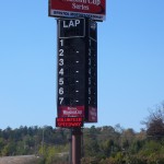
Here is a little, old church building sitting right on the road. Something about it caused me to take this photo. 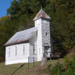
We ended the day in the small town of Bulls Gap. There are a couple of stores, a medical center, a couple of gas stations, and such on Route 11. One “block” off is “downtown.” We went over there and I took this photo. Downtown has five or six two-story brick buildings. The buildings are almost all abandoned. There is a railroad track going through downtown. It seems that the downtown area starting dying when the train stopped stopping here. A long freight train was chugging through town while we were there. I know it is business in a free enterprise system, but it is sad to see a town die because of a business decision. I put this photo on the Wikipedia page for Bulls Gap. 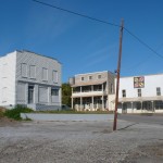
Tags: Greene County · Hawkins County · Tennessee
Well, here it is. The sign seen over and over and over and over while walking in Virginia. 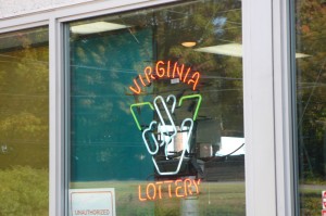
Yes, the Virginia Lottery sign. I guess maybe I could have bought some tickets to see what all the excitement is about. We saw this sign in almost every gas station in Virginia. I think most of the money goes to education or something worthwhile enough to sell to the taxpayers. Somebody wins some money now and then.
The real winner seems to be the company that makes these signs. I wonder how many of them they have sold.
Tags: Virginia
by Dwayne Phillips
This is the second most asked question.
Did you see such-and-such thing when you were near such-and-such city?
The answer is usually, “no.” The reason is simple,
We are walking on U.S. Route 11. If it isn’t on this road, we won’t see it.
In some ways, this is narrow minded. This is, however, the purpose of the walk – travel from our home in Reston, Virginia to Southeastern Louisiana on U.S. Route 11.
Just like the most-asked question (are you losing weight?), there are too many sights to see, too many interesting places “just a little off the path.”
So far, we have taken two quick side trips. One to Bridgewater College and one to Emory & Henry College. I like to visit small, old colleges. Both of these were less than three miles off Route 11.
Tags: Uncategorized
by Dwayne Phillips
Today we walked the 15 miles that brought us into Greeneville, Tennessee. It was a chilly 45 degrees F this morning and later in the day, well I am not sure about the temperature later in the day. It changed drastically minute by minute.
Route 11E in this part of Tennessee bypasses most of the towns. It is like an Interstate with businesses and houses on it. The road doesn’t go through towns. We passed near Limestone and Chuckey (what a great name), Tennessee.
We passed by Tusculum, but we walked off Route 11E for 1.5 miles so we could go through Tusculum.
Tusculum is the home of Tusculum College. This college was formed in 1794. It is the oldest college in Tennessee and the oldest college in America “west of the mountains” (the Allegheny or Appalachian mountains that is). These are the same claims made by nearby Washington College Academy. I don’t know which is technically true, but since Tusculum College was formed by the son of the man who formed Washington, I have to go with Washington.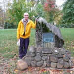
Here am I standing next to a historical marker at the college. Like several of the other older colleges we have visited, this is absolutely beautiful. Colleges are supposed to look just like this place. Big, shady oak trees. Big red-brick buildings with columns in the front and grand stairs leading to big doors.
We are staying at a motel in Greeneville. I think we are in Greeneville. Route 11E sort of by passes Greeneville as well. There is a Super Wal-Mart on the road along with fast food places, car dealerships, shopping centers, and you know, the usual Golden Mile type of thing. Traffic is surprisingly heavy here for a city of 15,000 people.
The weather today? It was sunny and 45 degrees when we started walking at 8:30 AM. I was cold, but warmed myself my walking fast and holding my arms across my chest. The rest of the day clouds came in the area and the sun went in and out, in and out, in and out. When the sun was shining, it was 55 degrees and pull off the wind breaker time. Then the sun was blocked by clouds and it was put the jacket back on and zip it up time. This hot and cold cycle happened a dozen times. Not a bad problem to have, but a nuisance.
I was able to have a better view of the east Tennessee countryside. Good rolling farmland with big barns. I saw tobacco hanging in a lot of the barns.
I was treated to a rolling auto show in the morning. There were about a dozen cars and trucks in a group on the road. Several were “hot rod” custom jobs while the rest were restored cars from the 1940s and 1950s. The trouble with such sights is that I cannot pull my camera from backpack fast enough to take a photo.
It is obvious that we are in Tennessee and not Virginia. The name “Robert E. Lee” has disappeared and been replaced with “Andrew Johnson.”
Tags: Greene County · Tennessee · Washington County
by Dwayne Phillips
This is the single most asked question about this taking a walk.
The answer is, “no.”
There are various reasons including:
- I didn’t have weight to lose.
- We are walking with a car, not hiking.
- Losing weight requires going hungry, and I don’t want to do that now. I have enough to think about already.
The main reason is,
There are too many good places to eat along the side of the road all day.
We cannot eat at every place we see. We cannot eat at every interesting place we see. We cannot eat at every place that smells like they are cooking something extra good.
We cannot do these things because:
- We don’t have enough money.
- We don’t have enough time.
- Our bodies would explode.
Consider as an example, hot dogs. I love hot dogs. I love a wide variety of variations of hot dogs.
Every gas station in America today sells fresh-cooked hot dogs. They all have those machines where the wieners roll back and forth on those hot rollers. Gas stations sell these good hot dogs at really low prices. One place had two hot dogs and a 20-ounce drink for less than $2. That is a steal!
I walk by six to ten hot dog selling places every day. I have yet to walk into one and buy a hot dog. I must say that is remarkable self control or self denial or just plain stupidity. But anyway, I digress.
Moon Pies, now that is different. Did you know they make Strawberry and Orange flavored Moon Pies? I only knew about Chocolate, Banana, and Vanilla. I have to get a Moon Pie when I buy a cup of coffee at a gas station.
But I digress.
The point is, I am not losing weight. I am walking 15 miles a day, eating a small sandwich for lunch, and struggling to keep from gaining weight. This wasn’t part of the plan.
Tags: Uncategorized
by Dwayne Phillips
Today we walked through Johnson City and Jonesborough, Tennessee. The temperature only ranged from 55 to 60 degrees F as mist and drizzle fell all day.
Route 11E misses downtown Johnson City and any interesting things there. It starts at I-26 and does the usual Golden Mile things. Then there are some nice suburbs, then a fading business area on the west (by the compass) side of the city.
Funny thing about cities is there is money on the side of the road. I picked up over 50 cents today in Johnson City. In rural areas the only of value on the side of the road are lone gloves. I think they blow out of the back of pickup trucks and other work vehicles.
I walked in front of another Starbucks coffee in Johnson City. This is the second in three days and only the second on the entire Route 11. Tennessee has a 9.5% sales tax on coffee at these places! Whose idea was that?
Jonesborough is another historic town that Route 11 bypasses. All that is on 11 are fast food places, other restaurants, shopping centers, and gas stations. To dry out from the drizzle, we ate at a Bar-B-Que place on 11 and then took a quick drive through downtown. It is worth visiting in better weather.
We walked another 7 or 8 miles from Jonesborough towards Greeneville. The weather was still lousy, but the countryside is beautiful. There are farms and pastures and hills with colorful trees to rival any we have seen so far.
Something new today – the speed limit on Route 11 is 65 MPH. This really is like walking on the side of an Interstate highway.
Drizzle – yes a wet day. Half the water that hit us was thrown by the cars and especially the trucks. It wasn’t comfortable, but not miserable like yesterday. It was fun in some absurd way.
The day ended in yet beautiful absurdity. We were parked next to a patch of cactus. What else would you see on a drizzly day in the hills of Eastern Tennessee but cactus? 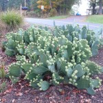
Tags: Sullivan County · Tennessee · Washington County
by Dwayne Phillips
Today we walked from the southern edge of Bristol through Piney Flats and into Johnson City, Tennessee. We walked 17 miles. The skies were overcast all day. It was windy, and the temperatures ranged from 60 to 75 degrees F.
There were two interesting objects near Bristol. First is this Drive-In Movie Theatre. It doesn’t have a name, but as you can see is closed until spring. It is in excellent condition.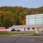 I am surprised at the number of drive ins I have seen. I thought all these went away twenty years ago.
The next site is of course the Bristol Motor Speedway. I believe this is the largest man-made structure we have seen so far. 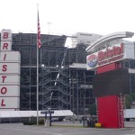
The rest of today’s walk was rather uneventful. Route 11 (11E to be exact) here is a four-lane divided highway with a large median and wide shoulders. Walking here is the closest thing to walking on an Interstate highway there is. The constant traffic causes a constant wind. The noise is awful. It made for a miserable walking experience. This is the first day of the walk that I write such – that the conditions were miserable. We have had several days of foggy and misty rain, but this was worse. The wind and noise wore on me.
Here is a sign of increasing wealth: the mobile home sales businesses were replaced by RV (recreational vehicle) sales businesses as we approached Johnson City. The RVs cost more than the complete mobile homes.
The area between Bristol and Johnson City surprised me in that it was mostly rural. Maybe it is the size of the highway here, but the homes are spread more than when Route 11 was a two-lane road in Virginia. I’ll have to keep watch on this.
Piney Flats has a great name. It actually has a little page on Wikipedia as well. It is a cluster of fast food places, several shopping centers, and two traffic lights just north of Johnson City. We bought coffee and a sandwich at the Burger King. They have this wonderful elderly woman walking about wiping the tables and replacing the napkins in the napkin holders on the tables. I liked seeing that. I guess she is in her 70s, and she doesn’t move too fast, but she is working.
We haven’t seen much of Johnson City yet. We are on the northern edge near Interstate 26. Just Golden Mile junk so far. Maybe something interesting tomorrow.
I lost my car key. We called around and will have to go to a Chevy dealership first thing in the morning. The keys have smart chips in them, so you can’t have a key made just anywhere. When did they start that? Who thought that would be a good idea?
We crossed the Holston River and part of Boone Lake on today’s walk. The water level is very low for both places. They both have fabulous $$$$ waterfront homes. These poor rich people, however, cannot put their boats in the water from their boat houses. If they tried, they would drop their boats on rocks. Where did the water go? Is Eastern Tennessee having a drought?
Last thing, I thought I was walking all day on a flat shoulder. It sure looked flat. Ten miles into the day my ankles and feet informed me that despite appearances, I was walking on a right-to-left slope. Ankles and feet don’t lie.
Tags: Sullivan County · Tennessee


