by Dwayne Phillips
I have seen fire hydrants on several stretches of road. I am all for fire hydrants, fire safety, lower home owners insurance rates, and so on. I am also puzzled by a fire hydrant every quarter mile for miles on end out in the country. Sometimes there are eight hydrants per mile. Often there are no homes or other structures in sight, but here are the fire hydrants.
Most of them are red, like this one. 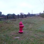
Some of them are other colors like this one. Note that the perspective of the photo makes the hydrant look larger than the silo. It isn’t.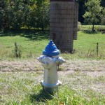
One thing they all have in common is that the grass is cut around them. Someone comes out weekly and maintains the ground about them.
This all seems expensive. I am guessing that this is funded by the Federal government.
I don’t get it.
Tags: Uncategorized
by Dwayne Phillips
Today we walked through the towns of Elliston and Shawsville and stopped on the outskirts of Christiansburg, Virginia. We walked about 12 miles. The day started at 45 degrees F and ended around 70 degress. The skies were clear with mild winds.
The day started at the border of Montgomery and Roanoke Counties where the Roanoke River crosses Route 11. Yesterday ended with a down hill trek to the river.
About 8 miles of today’s walk went through a small valley. God created this little valley and He hid it here in this little pocket of southern Virginia. The morning started walking along side a railroad track. A freight train passed. It was so long that both ends disappeared around long bends. I haven’t seen such a train in years.
The trees here already have turned red, yellow, and orange. On some hills there was a dividing line running vertically where the master painter splashed those autumn colors on one side, but took a nap and has yet to splash the other side.
There are horse farms in this valley. Long, white wooden fences border rolling pastures. The color of the grass holds all the water and life of the valley. The homes are immaculate as they sit next to stables and barns.
The towns here are not the Main Street towns seen elsewhere. U.S. Route 11 is here a four-lane divided highway. A town is a group of several dozen houses in close proximity with a gas station and a Post Office. Shawsville is about triple the size of Elliston. It has three gas stations and more businesses. Shawsville also has an “Oldtown Road.” A half-mile road set halfway up a hill that parallels Route 11. There are four or five older and larger brick buildings on that road. They are all abandoned. Perhaps they were built on the hillside to stay away from possible flooding in the valley floor.
A poet once wrote that only God can make a tree. Let’s add that only man can build power lines above and through a tree and then dispatch a crew to butcher the tree so it doesn’t foul the power lines. For much of this little valley, the power lines run away from Route 11. This allows the trees to grow and shape the way the maker intended. Place these trees next to the aforementioned pastures and speckle them with colors.
If you ever want to walk about ten miles of beauty, visit this valley. This is my favorite stretch of rural road so far.
A surprise for me is that both Elliston and Shawsville have Wikipedia pages. I added photos to those pages.
I knew I was leaving the valley when I started climbing a hill. I walked uphill for at least an hour. My estimates with a GPS and topogrpahical maps is that I climbed 600 feet. We stopped at the intersection of Route 11 and Interstate 81 just north of Christiansburg.
Tags: Montgomery County · Virginia
by Dwayne Phillips
We drove through Roanoke and then walked through Salem, Virginia. This was a cool day (55 to 65 degrees F). It was also quite windy – 20 MPH winds.
We drove through Roanoke. Still we were lost several times and had to back track to find how Route 11 goes through the city. Walking and being separated at times would have been a nightmare.
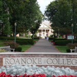
Salem is a nice small city. The downtown area is mostly 20th century, but well kept and busy with storefronts and restaurants. It is a good stroll through downtown. The highlight for me was Roanoke College (1842). A college is supposed to look like this. Red brick buildings, trees, walkways. It looks so peaceful and inviting.
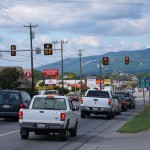
South of downtown was a cursed golden mile. Actually it is west of downtown. Highways often wander through the land in various directions. A times today Route 11 went north, west, south, and east. Here is a photo of the golden mile. I hate walking along the sidewalk of these. I know there is economic good and such, but I just don’t find anything interesting here.
 Highlight of the day – a large tree overhanging the Roanoke River south of Salem. As I approached it I was thinking, “boy, this is a great spot for a rope to swing on.” There it was, the imagined rope swing. It was as if someone had placed a marble and brass marker next to the road reading:
Fun here for generations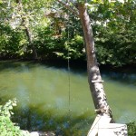
We are definitely out of the Shenandoah Valley. The ups and downs in Route 11 are several hundred feet high.
A sign of encouragement:
Bristol 135
This is the first sign on Route 11 I have seen that mentions the Virginia-Tenessee border town. It is one of our goals for October.
Tags: Montgomery County · Roanoke County · Virginia
by Dwayne Phillips
Today we walked through Troutville and Cloverdale, Virginia. We again covered 15 miles. The morning temperature was 55 degrees F and the afternoon was 70 degrees.
These two areas are northern suburbs of Roanoke. Wikipedia describes them as being “part of the Roanoke Metropolitan Statistical Area.” If that isn’t a degrading comment, I don’t know what is. Anyways, as such, well, they are such and such. I don’t get much from suburbs. Route 11 tends to be a main drag through shopping centers, care dealerships, mobile home dealerships, RV dealerships, and so on.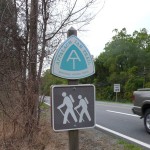
Two highlights of the day. First, we crossed the Appalachian Trail in Troutville. We cross the trail back on Day 5 on Virginia Route 7 east of Winchester. Every day of walking down the roadside I gain more respect for the people who hike the trail. The difficulty of the trail over what we are doing must be ten-fold.
I put this photo and another photo on the Troutville, Virginia page on Wikipedia.
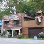
The other small highlight was Kelly’s Real Deals on the side of the road. Any place with a steer’s head sticking out of the wall is okay with me.
Tags: Botetourt County · Roanoke County · Virginia
September 30th, 2008 · No Comments
by Dwayne Phillips
Some endless digging (well, only ten minutes on Google and Wikipedia) and I have solved the mystery of the bicycle sign shown here: 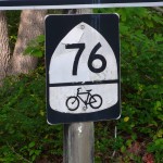
This is from U.S. Bicycle Route 76. That route, established by the U.S. government in 1982 (see, we aren’t all a waste of money) runs from Illinois through to the Atlantic coast of Virginia. It is one of two U.S. Bicycle Routes. The other is U.S. Bicycle Route 1 from Florida into Virginia.
I am not so sure about riding a bicycle on this route. Few if any of the places we have seen the sign look good for bicycles.
There is no end to what you might learn out here folks.
Tags: Uncategorized
September 30th, 2008 · No Comments
by Dwayne Phillips
Today we walked from south of Natural Bridge through Buchanan, Virginia. The walk was 95% countryside with only one town. The weather started at 55 degrees F and quite foggy and ended at sunny and 80 degrees. Once again the predicted rain did not occur. If you are a farmer desiring rain, don’t let us walk through.
The entire morning was somewhat depressing. The countryside from Natural Bridge to Buchanan looks poor. Small or collapsing houses and house trailers. The land is rocky and wooded. I just had a bad feeling going through it.
We came to Buchanan, and I expected much of the same. I was pleasantly wrong. Buchanan, Virginia is an excellent small town. I recommend visiting it.They have more restaurants per step than any of the other small towns we have visited.
We crossed the James River and saw this magnificent swinging foot bridge. The current Route 11 bridge was built in 1937. The town built the swinging bridge in 1938. The stone piers for the swinging bridge are from a toll bridge in 1851. Karen and I walked back and forth across the bridge. It does swing. Great!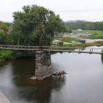
I put the photo of the swinging bridge as well as a photo of Buchanan’s Trinity Episcopal church on the Buchanan page of Wikipedia.
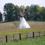
South of Buchanan we found this tee pee in a field. It looks pretty authentic. It comprises wooden poles and a large piece of canvas (sorry, no buffalo hides). I have no idea why this is here. It is an impressive site.
The countryside south of Buchanan appears far more prosperous than the area north of town. I felt much better than in the morning.
Buchanan’s town sign claims that it is the “Gateway to the Shenandoah Valley.” This is a reasonable yet debatable claim. The official tourism web site for the valley includes Roanoke in the valley. Roanoke is some 20 miles south of Buchanan, so…
One last thing. We keep seeing this sign, but we have no idea what it means. Anyone out there have a clue? 
Tags: Botetourt County · Rockbridge County · Virginia
September 29th, 2008 · No Comments
by Dwayne Phillips
Today we walked through Lexington, Fancy Hill, and Natural Bridge, Virginia. The weather returned to normal conditions: 65 in the morning and 80 in the afternoon with clear skies. We walked another 15 miles.
Lexington was founded in 1778. This is a great small city to visit. It has two historical universities sitting on Route 11 one block apart: Virginia Military Institute (1839) and Washington and Lee University (1749 – 1749? That makes it older than…well you know). I have never seen such a wide range in university culture in one block. VMI is painted a pale green and everyone is wearing creased uniforms. Washington and Lee is red brick with white columns and everyone is wearing t-shirts, baggy shorts, and flip flops. Each has its own charm.
I sense money in Lexington. Everything in the 12 to 16 square block downtown is either in good shape or being put into good shape. Businesses, coffee shops, theaters, art, crafts, antiques, church buildings, and history. “Just another house” in Lexington would be the most impressive house in most of the towns we have transited so far. Same with “just another church building” in Lexington. This place has more sights per step than anything else I have seen.
If you have one day or weekend to spend in the Shenandoah Valley, spend it in Lexington.
My highlight of Lexington was near the south edge of town as we walked past a home for retirees. There was a man sitting out front who looked to be 90 smoking a cigarette. If you live to his age, why not smoke?
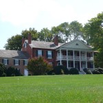 Fancy Hill is barely a wide spot in the road, but it is impressive. Massive rolling pastures. At the top of Fancy Hill was this farm home. Impressive.
Then you move on to Natural Bridge. The natural bridge is a rock formation of an arch or a bridge that is about 200 feet high. This was the most impressive natural feature known to the European settlers in the New World for many decades. Thomas Jefferson obtained a land grant to preserve it in 1774. Now as I reckon, 1774 was several years before America, so I guess some King or Queen granted that land. I guess those guys weren’t all bad.
Natural Bridge is a class act. The Hotel there by the same name is an impressive site and well maintained. The rooms are good and the restaurant is excellent.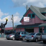
In the area are some excellent examples of 20th century roadside Americana. Five miles north near I-81 is the Pink Cadillac Diner. Note to color of the diner. King Kong is in his natural black fur.
Nearer to Natural Bridge is “FoamHenge” patterned after that really old place in Britain. I guess the monoliths on the hillside are made of foam. This is all good fare.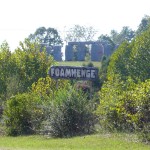
A note about the terrain. Route 11 curved often and went up and down steep hills lined by large rock formations. Hence, the name of the county – Rockbridge – and the location of the natural bridge. See this image and note all the contour lines the road winds through and climbs.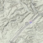
Tags: Rockbridge County · Virginia
September 27th, 2008 · No Comments
by Dwayne Phillips
I am walking in a south westerly direction each day. I don’t walk north and I don’t walk east. The sun hits my in the back and on my left side in the morning. The sun gradually moves around to hit my face and right side in the afternoons. Maybe someone who knows much more than I about the position and path of the sun at this latitude and this time of year can comment and explain how all this works.
I have been walking about three hours in the morning and three hours in the afternoon. That is pretty even by my reckoning.
But something isn’t working. The left side of my neck and face is two shades darker than the right side. This doesn’t look good in the mirror.
I am searching for solutions. My first thought is to put a triple coating of sun screen on my left side. Ick. Maybe I can hang a bandanna on my left side as a curtain. I don’t like the look of that, but if it works I can live with it.
Suggestions? Similar experiences?
Tags: Observations
September 26th, 2008 · No Comments
by Dwayne Phillips
Today we walked through the village of Fairfield, Virginia (that’s what their sign read – “village”). That was the only town or village or anything we transited). We covered about 13 miles. Rain was forecast, but except for some drizzle in the morning, we were dry.
The three miles north of Fairfield and the ten miles south of it were all rural. Beautiful farm land with much more livestock grazing and much fewer crops. There were times when I wondered if I would see anything of note. Mile after mile of cows and pastures.
Then I came upon a couple of historic markers. The first one was about a Captain John McDowell who died in an encounter with Iroquois Indians at that spot on December 18th, 1742. That was a long time ago, and it happened right here where Route 11 passes. I don’t know what army Captain McDowell was a Captain in – Her Majesty’s Army? McDowell, and a few relatives, is buried near the marker in the pasture 50 yards off the road.
Next to this marker was another dedicated to Ephraim McDowell (born November 11, 1771). He started studying medicine in Staunton, Virginia and then continued his studies in Edinburgh, Scotland. How do you get from Staunton to Edinburgh??? I know, family connections. Anyways, Ephraim is known as the Father of Abdominal Surgery. I guess he was the first guy who could cut open my belly and know what went where. All kidding aside, that is significant.
I am amazed that this route I am walking carried such people such a long time ago. This is a natural route through the valley. Maybe politics had less influence on road routes in those days.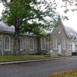
More history a few miles down Route 11. Here is the Timber Ridge Presbyterian Church. This building was constructed in 1756. I am getting good at the math – the building is 20 years older than America. By the way, the congregation began in 1746. They waited ten years to collect the stones and raise the building.
Enough really old things. Now to some mid-twentieth century cool stuff – another drive-in movie theater. Here it is, just south of I-81 and about six miles north of Lexington, Virginia. Hull’s Drive-In. They are still showing movies in the fall. Great stuff!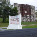
Tags: Rockbridge County · Virginia
September 25th, 2008 · No Comments
by Dwayne Phillips
Today we walked through Mint Springs, Greenville, and Steeles Tavern, Virginia. The first and the last were wide spots in the road. We covered 15 miles.
The weather was odd. We started at cloudy, windy, and 55 degrees F. We ends at light rain, windy, and 52 degrees. Is this September?
Mint Springs was a wide spot in the road. I have called several towns by this name. What I mean is that they have a simple sign on the road as shown in the photo. There is no historic downtown or any town to mention. Sometimes there is a Post Office, but more likely not. 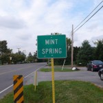
South of Mint Springs, Route 11 became a “country living” development. Farms and farm-related businesses were replaced by newer homes on on-half and one-acre lots. Nice places for commuters to live, but they have to cut all that grass!
Next up is Greenville. This is a town with a Main Street lined with houses and a few businesses right on the road. Greenville breaks the pattern in that its “Main Street” is one block off of Route 11. We walked up Route 11 and back down Main Street. There wasn’t much in this small town. Here is a photo of the Greenville United Methodist Church – the most impressive structure in town. 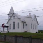
After Greenville, farms and farm businesses returned. Ah, I understand this – farms in a rural area.
Steeles Tavern was the last town of the day. It was a wide spot in the road. Here is a photo of one of the few buildings inside the simple green signs. It is the U.S. Post Office. If you look closely you will see that some of the letters have fallen off the building. Oh well.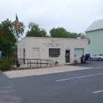
Now to the title of the post – Motels to Apartments. Along Route 11 so far, I have seen a couple dozen of the old Motor Court Motels. Some of these have cottages, some cabins, and some two or three different buildings to hold the motel rooms. Many of these have gone to the weeds as people travel I-81 instead of Route 11. Some, however, have been converted to apartments. Here is a photo of one that is south of Greenville. It isn’t much to see, but it is a trend on these back roads highways.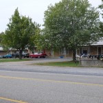
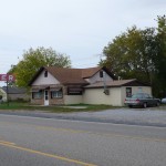
Another trend is the death of the Diners. Some, like the one in this photo, have been converted to houses. I suppose being a house is better than being a home for rats and snakes. It is too bad that these businesses couldn’t survive the onslaught of the Interstates and the Golden Miles.
 One more thing, the title “Valley Pike” has been replaced by “Lee Highway” on the street signs along Route 11. I am not sure what that means.
Tags: Augusta County · Rockbridge County · Virginia


